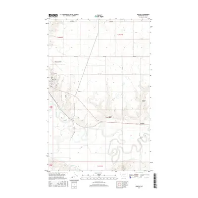
2017 Map of Whately
USGS Topo · Published 2017About this map
The Milk River meanders through this section of Valley County, creating a complex series of oxbows and wetlands that define the local geography. Just north of these bends, the city of Glasgow serves as a regional hub, its streets including Aberdeen St and Scotty Pride Dr extending toward the Glasgow Highland Cem and the extensive runways of Wokal Field/Glasgow International Airport. The terrain transition is sharp where the river valley meets the upland breaks, marked by deep drainages like Goudee Coulee and Whately Coulee.
Find a feature on this map
38 named features on this map. Tap any name to fly to it.
Don’t see what you’re looking for? This feature index may not catch every label — zoom into the map to look around manually.
Map Details
Editions of this 2017 Whately Map
This is the sole edition of this map. No revisions or reprints were ever made.
Other maps of this area

1914 · Nashua
USGS Topo · 1:62,500

1916 · Nashua
USGS Topo · 1:62,500

1918 · Porcupine Valley
USGS Topo · 1:62,500

1943 · Glasgow
USGS Topo · 1:125,000

1954 · Glasgow
USGS Topo · 1:250,000

1957 · Glasgow
USGS Topo · 1:250,000

1958 · Glasgow
USGS Topo · 1:250,000

1958 · Glasgow
USGS Topo · 1:24,000
1958 · Blanchard Ranch
USGS Topo · 1:24,000

1958 · Wheeler
USGS Topo · 1:24,000