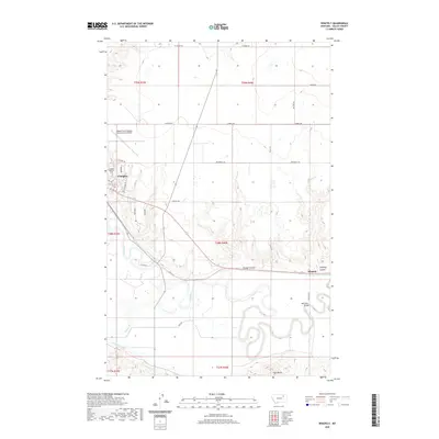
2020 Map of Whately
USGS Topo · Published 2020About this map
Glasgow serves as the primary hub of this landscape, situated along the northern banks of the meandering Milk River. This contemporary survey highlights the integration of modern transportation and agricultural water management in Valley County, featuring the Wokal Field/Glasgow International Airport and the engineered irrigation routes of the Vandalia S Canal. Outside the city center, the terrain is defined by dry-land coulees such as Goudge Coulee and Whately Coulee that lead down toward the river valley. The map documents smaller settlements like Whately and rural outposts including Blanchard Ranch, providing a record of land use at the dawn of the 2020s. Local history and genealogy points are noted at the Glasgow Highland Cem, while topographical markers like Tiger Butte rise above the surrounding plains to the south.
Find a feature on this map
39 named features on this map. Tap any name to fly to it.
Don’t see what you’re looking for? This feature index may not catch every label — zoom into the map to look around manually.
Map Details
Editions of this 2020 Whately Map
This is the sole edition of this map. No revisions or reprints were ever made.
Other maps of this area

1914 · Nashua
USGS Topo · 1:62,500

1916 · Nashua
USGS Topo · 1:62,500

1918 · Porcupine Valley
USGS Topo · 1:62,500

1943 · Glasgow
USGS Topo · 1:125,000

1954 · Glasgow
USGS Topo · 1:250,000

1957 · Glasgow
USGS Topo · 1:250,000

1958 · Glasgow
USGS Topo · 1:250,000

1958 · Glasgow
USGS Topo · 1:24,000
1958 · Blanchard Ranch
USGS Topo · 1:24,000

1958 · Wheeler
USGS Topo · 1:24,000