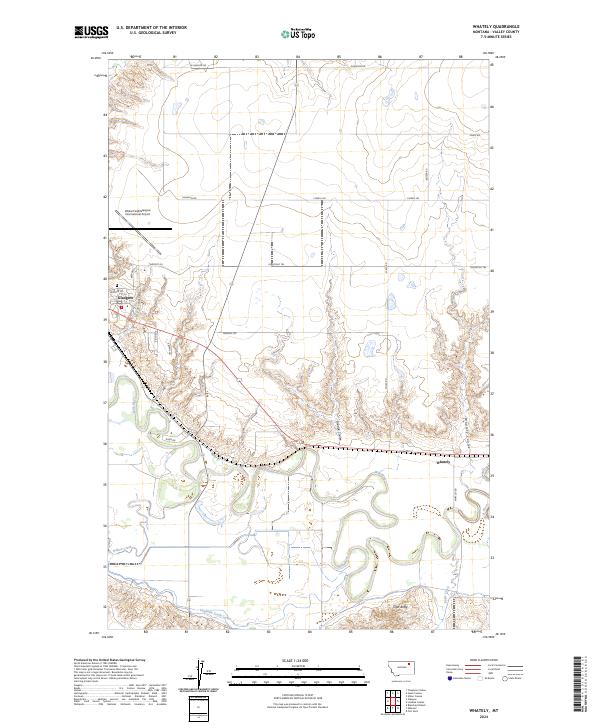
2024 Map of Whately
USGS Topo · Published 2024About this map
The Milk River meanders across this landscape of Valley County, defining the valley floor south of the regional hub at Glasgow. This contemporary survey illustrates the irrigation infrastructure critical to the area's agricultural history, specifically the Vandalia South Canal which traverses the southern portion of the quadrangle. North of the river, the terrain rises toward the high plains, punctuated by drainage features like Goudge Coulee and Whately Coulee. At the edge of the breaks, the small settlement of Whately sits near the rail line and river bend, while the northwestern corner is dominated by the runways of Wokal Field/Glasgow International Airport. High points such as Tiger Butte provide a vertical contrast to the riparian zones of Willow Creek and Dodge Creek, reflecting the mixed ranching and transit character of this northern Montana region.
Find a feature on this map
35 named features on this map. Tap any name to fly to it.
Don’t see what you’re looking for? This feature index may not catch every label — zoom into the map to look around manually.
Map Details
Editions of this 2024 Whately Map
This is the sole edition of this map. No revisions or reprints were ever made.
Other maps of this area

1914 · Nashua
USGS Topo · 1:62,500

1916 · Nashua
USGS Topo · 1:62,500

1918 · Porcupine Valley
USGS Topo · 1:62,500

1943 · Glasgow
USGS Topo · 1:125,000

1954 · Glasgow
USGS Topo · 1:250,000

1957 · Glasgow
USGS Topo · 1:250,000

1958 · Glasgow
USGS Topo · 1:250,000

1958 · Glasgow
USGS Topo · 1:24,000
1958 · Blanchard Ranch
USGS Topo · 1:24,000

1958 · Wheeler
USGS Topo · 1:24,000