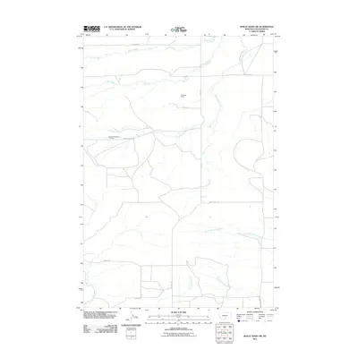
2011 Map of Wheat Basin SW
USGS Topo · Published 2011About this map
Holland Settlement anchors this portion of Stillwater County, where the high plains landscape is dissected by a network of drainage systems. The northern reaches are defined by Struck Creek and Toll Creek, while the central area is dominated by the wandering path of Greenwood Creek, which passes near a local Cemetery and Rummel Dam. This region is characterized by its organized grid of rural roads, including Bondurant Rd and Cadillac Hill Rd, which connect isolated homesteads to the wider agricultural basin. To the south, the topography transitions into the valley systems of North Fork Valley Creek and South Fork Valley Creek, eventually meeting the headwaters of Keyser Creek. The distribution of these watercourses and named roads reflects the enduring agricultural footprint of this Montana landscape in the early 21st century.
Find a feature on this map
20 named features on this map. Tap any name to fly to it.
Don’t see what you’re looking for? This feature index may not catch every label — zoom into the map to look around manually.
Map Details
Editions of this 2011 Wheat Basin SW Map
This is the sole edition of this map. No revisions or reprints were ever made.
Other maps of this area

1892 · Stillwater
USGS Topo · 1:125,000

1954 · Billings
USGS Topo · 1:250,000

1956 · Columbus West
USGS Topo · 1:24,000

1956 · Rapelje
USGS Topo · 1:24,000

1956 · Hunter Lake
USGS Topo · 1:24,000

1956 · Battle Butte
USGS Topo · 1:24,000

1956 · Horse Butte
USGS Topo · 1:24,000

1956 · Wheat Basin
USGS Topo · 1:24,000

1956 · Columbus East
USGS Topo · 1:24,000

1956 · Lindemulder Hill
USGS Topo · 1:24,000