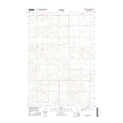
2017 Map of Wheat Basin SW
USGS Topo · Published 2017About this map
The Holland Settlement Cem serves as a quiet landmark in this rural Stillwater County landscape, which is defined by its complex drainage network and Section-line road system. Multiple small watercourses including Greenwood Cr, Toll Cr, and Struck Cr carve through the terrain, illustrating the hydrologic patterns that shaped early settlement. The road network follows the Public Land Survey System grid with precision, featuring routes such as Battle Butte Rd, Peterson Rd, and Visser Rd that connect isolated homesteads and ranching tracts. In the southern portion of the map, the landscape transitions toward the valleys of N Fork Valley Cr and S Fork Valley Cr, intersected by Columbus Molt Rd. This 2017 survey provides a detailed look at the rural infrastructure of the Wheat Basin area, documenting the persistence of family-named roads and remote burial sites.
Find a feature on this map
24 named features on this map. Tap any name to fly to it.
Don’t see what you’re looking for? This feature index may not catch every label — zoom into the map to look around manually.
Map Details
Editions of this 2017 Wheat Basin SW Map
This is the sole edition of this map. No revisions or reprints were ever made.
Other maps of this area

1892 · Stillwater
USGS Topo · 1:125,000

1954 · Billings
USGS Topo · 1:250,000

1956 · Columbus West
USGS Topo · 1:24,000

1956 · Rapelje
USGS Topo · 1:24,000

1956 · Hunter Lake
USGS Topo · 1:24,000

1956 · Battle Butte
USGS Topo · 1:24,000

1956 · Horse Butte
USGS Topo · 1:24,000

1956 · Wheat Basin
USGS Topo · 1:24,000

1956 · Columbus East
USGS Topo · 1:24,000

1956 · Lindemulder Hill
USGS Topo · 1:24,000