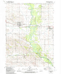
1991 Map of Wheatland
USGS Topo · Published 1992About this map
The Wapsipinicon River carves a winding path through the center of this landscape, flanked by the Syracuse State Wildlife Management Area and Sherman Park. The river valley acts as a natural divide between the townships of Spring Rock and Olive, with the watercourse crossed by the High Rock Bridge. To the north, the town of Wheatland serves as a local hub, situated along the Chicago and North Western railroad line.
Find a feature on this map
36 named features on this map. Tap any name to fly to it.
Don’t see what you’re looking for? This feature index may not catch every label — zoom into the map to look around manually.
Map Details
Editions of this 1991 Wheatland Map
This is the sole edition of this map. No revisions or reprints were ever made.
Other maps of this area

1890 · Durant
USGS Topo · 1:62,500

1891 · DeWitt
USGS Topo · 1:62,500

1891 · Davenport
USGS Topo · 1:62,500

1892 · Wheatland
USGS Topo · 1:62,500

1894 · Wheatland
USGS Topo · 1:62,500

1894 · Durant
USGS Topo · 1:62,500

1894 · Davenport
USGS Topo · 1:62,500

1901 · Rock Island
USGS Topo · 1:125,000

1910 · Rock Island
USGS Topo · 1:125,000
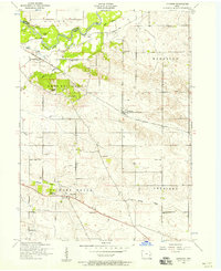
1953 · Donahue
USGS Topo · 1:24,000