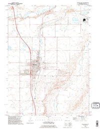
1990 Map of Wheatland
USGS Topo · Published 1995About this map
Wheatland serves as the central hub of this High Plains landscape, where the confluence of irrigation and transport shaped local development. The town's grid is surrounded by vital water sources including the Laramie River, Wheatland Creek, and Chugwater Creek, supporting a patchwork of agricultural lands and ranches like Bard Ranch and Phifer Ranch. The presence of Festo Lake and Jones Lake highlights the importance of water storage in this semi-arid region, while the Wheatland Cemetery and various athletic fields mark the community's social footprint.
Find a feature on this map
24 named features on this map. Tap any name to fly to it.
Don’t see what you’re looking for? This feature index may not catch every label — zoom into the map to look around manually.
Map Details
Editions of this 1990 Wheatland Map
This is the sole edition of this map. No revisions or reprints were ever made.
Other maps of this area

1896 · Hartville
USGS Topo · 1:125,000

1901 · Hartville
USGS Topo · 1:125,000

1951 · Dwyer
USGS Topo · 1:24,000

1951 · Antelope Gap
USGS Topo · 1:24,000
1951 · Wheatland
USGS Topo · 1:24,000
1951 · Wheatland NE
USGS Topo · 1:24,000

1953 · Lewis Flat
USGS Topo · 1:24,000

1953 · Hightower
USGS Topo · 1:24,000

1953 · Natwick
USGS Topo · 1:24,000

1953 · Ferguson Corner
USGS Topo · 1:24,000