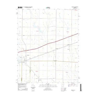
2014 Map of Wheatley
USGS Topo · Published 2014About this map
The town of Wheatley serves as a central hub on this East Arkansas landscape, where the local street grid including Little Rock St and S Memphis Ave meets the surrounding agricultural expanse. This survey captures a rural network of small settlements and family burial grounds that define the local genealogy, including the Goodwin Cemeteries near Goodwin and the Waldrop Cem north of the main town. The terrain is shaped by the meandering courses of Big Creek and the West Flat Fork Creek, which drain the flat delta lands. Distinctive rural place names like Blossom, Posey, and Nash Corner mark the intersections of county roads, such as Doc Edgar Rd, illustrating the persistent settlement patterns of St. Francis and Lee Counties. Small landmarks like the Pilgrim Rest Cem and Johnson Cem provide specific points of interest for those tracing family history in the region.
Find a feature on this map
64 named features on this map. Tap any name to fly to it.
Don’t see what you’re looking for? This feature index may not catch every label — zoom into the map to look around manually.
Map Details
Editions of this 2014 Wheatley Map
This is the sole edition of this map. No revisions or reprints were ever made.
Other maps of this area

1939 · Wynne
USGS Topo · 1:62,500

1939 · Hunter
USGS Topo · 1:62,500

1940 · Brinkley
USGS Topo · 1:62,500

1940 · Marianna
USGS Topo · 1:62,500

1948 · Helena
USGS Topo · 1:250,000

1950 · Helena
USGS Topo · 1:250,000

1953 · Memphis
USGS Topo · 1:250,000

1955 · Helena
USGS Topo · 1:250,000

1956 · Memphis
USGS Topo · 1:250,000

1956 · Hunter
USGS Topo · 1:62,500