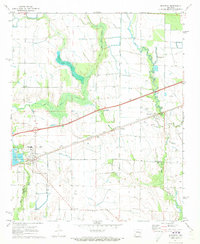
1971 Map of Wheatley
USGS Topo · Published 1973About this map
Wheatley and the surrounding Arkansas Delta farmland are defined here by a transition between traditional agriculture and modern infrastructure in the early 1970s. The Chicago Rock Island and Pacific railroad and U. S. 70 parallel each other across the landscape, connecting the small settlements of Goodwin and Blossom. The drainage patterns of Flat Fork Creek and Big Creek dictate the layout of the fields, which are dotted with family and community sites like Waldrop Cem, Johnson Cem, and Mt Olive Ch.
Find a feature on this map
31 named features on this map. Tap any name to fly to it.
Don’t see what you’re looking for? This feature index may not catch every label — zoom into the map to look around manually.
Map Details
Editions of this 1971 Wheatley Map
This is the sole edition of this map. No revisions or reprints were ever made.
Other maps of this area

1939 · Wynne
USGS Topo · 1:62,500

1939 · Hunter
USGS Topo · 1:62,500

1940 · Brinkley
USGS Topo · 1:62,500

1940 · Marianna
USGS Topo · 1:62,500

1948 · Helena
USGS Topo · 1:250,000

1950 · Helena
USGS Topo · 1:250,000

1953 · Memphis
USGS Topo · 1:250,000

1955 · Helena
USGS Topo · 1:250,000

1956 · Memphis
USGS Topo · 1:250,000

1956 · Hunter
USGS Topo · 1:62,500