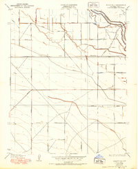
1931 Map of Wheatville
USGS Topo · Published 1950About this map
Wheatville and its surrounding agricultural landscape dominate this central Fresno County terrain as it appeared during the late 1920s. The region is defined by an intricate network of irrigation infrastructure essential to San Joaquin Valley farming, including the Stinson Canal, Crescent Ditch, and Laguna Ditch. These man-made waterways interact with the natural course of the Fresno Slough, which meanders through the northeastern corner of the quadrangle.
Find a feature on this map
24 named features on this map. Tap any name to fly to it.
Don’t see what you’re looking for? This feature index may not catch every label — zoom into the map to look around manually.
Map Details
Editions of this 1931 Wheatville Map
2 editions found
Other maps of this area

1912 · Coalinga
USGS Topo · 1:125,000

1925 · Helm
USGS Topo · 1:31,680

1925 · San Joaquin
USGS Topo · 1:31,680

1925 · Raisin
USGS Topo · 1:31,680

1926 · Lethent
USGS Topo · 1:31,680

1927 · Burrel
USGS Topo · 1:31,680

1928 · Delta Farms No 3
USGS Topo · 1:31,680

1931 · Wheatville
USGS Topo · 1:31,680

1931 · Towne Oil Station
USGS Topo · 1:31,680

1932 · Delta Farms
USGS Topo · 1:31,680