
1931 Map of Wheatville
USGS Topo · Published 1931About this map
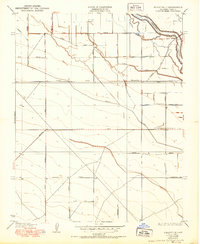
Wheatville stands at the heart of an intricate irrigation network in Fresno County, where a grid of rural avenues and water diversions defined the early 20th-century landscape. Surveyed in 1928, this map illustrates the systematic conversion of the Central Valley into highly organized agricultural units. The movement of water is the primary theme, managed through features like the Stinson Canal, Madera Canal, and the Elkhorn Ditch. The presence of the Fresno Slough in the northeast corner serves as a reminder of the region's natural hydrology before it was further constrained by the expanding canal system.
Find a feature on this map
23 named features on this map. Tap any name to fly to it.
Don’t see what you’re looking for? This feature index may not catch every label — zoom into the map to look around manually.
Map Details
Editions of this 1931 Wheatville Map
2 editions found
Other maps of this area

1912 · Coalinga
USGS Topo · 1:125,000

1925 · Helm
USGS Topo · 1:31,680

1925 · San Joaquin
USGS Topo · 1:31,680

1925 · Raisin
USGS Topo · 1:31,680

1926 · Lethent
USGS Topo · 1:31,680

1927 · Burrel
USGS Topo · 1:31,680

1928 · Delta Farms No 3
USGS Topo · 1:31,680

1931 · Towne Oil Station
USGS Topo · 1:31,680

1932 · Delta Farms
USGS Topo · 1:31,680

1932 · West of Lethent
USGS Topo · 1:31,680