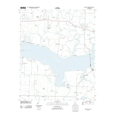
2012 Map of Wheeler Dam
USGS Topo · Published 2012About this map
Wheeler Dam and its adjacent Wheeler Dam Village anchor this section of the Tennessee River, where the landscape transitions from the open waters of Wilson Lake to the meandering courses of Town Creek and Big Nance Creek. The map documents a dense network of local family history, preserved in numerous burial grounds such as Old Tanyard Cemetery, Westmoreland Cemetery, and Hennigan Cemetery. Settlement patterns show a mix of established communities like Center Star and Elgin alongside smaller landings and hollows. The presence of Fosters Mill and Town Creek Marina indicates a river-based economy that balances historical industry with modern recreation. Geographically, the area is defined by varied terrain features including Bugger Bottom and Greens Bluff, reflecting the complex topography south of the river.
Find a feature on this map
151 named features on this map. Tap any name to fly to it.
Don’t see what you’re looking for? This feature index may not catch every label — zoom into the map to look around manually.
Map Details
Editions of this 2012 Wheeler Dam Map
This is the sole edition of this map. No revisions or reprints were ever made.
Other maps of this area

1914 · Rogersville
USGS Topo · 1:48,000

1914 · Muscle Shoals
USGS Topo · 1:48,000

1916 · Muscle Shoals
USGS Topo · 1:62,500

1916 · Rogersville
USGS Topo · 1:62,500

1924 · Tuscumbia
USGS Topo · 1:48,000

1926 · Tuscumbia
USGS Topo · 1:62,500

1936 · Thorntontown
USGS Topo · 1:24,000

1936 · Courtland
USGS Topo · 1:24,000

1936 · Lexington
USGS Topo · 1:24,000

1936 · Pruitton
USGS Topo · 1:24,000