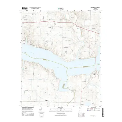
2014 Map of Wheeler Dam
USGS Topo · Published 2014About this map
The Tennessee River divides this landscape at the intersection of Lauderdale, Colbert, and Lawrence Counties, where the waters of Wilson Lake and Wheeler Lake meet. Modern infrastructure like Wheeler Dam Village and the historic Lock Three site reveal the long-standing importance of river navigation and power generation in this region. The map highlights the transition from the river's edge to the inland communities of Killen, Center Star, and Elgin, connected by the corridor of Highway 72.
Find a feature on this map
110 named features on this map. Tap any name to fly to it.
Don’t see what you’re looking for? This feature index may not catch every label — zoom into the map to look around manually.
Map Details
Editions of this 2014 Wheeler Dam Map
This is the sole edition of this map. No revisions or reprints were ever made.
Other maps of this area

1914 · Rogersville
USGS Topo · 1:48,000

1914 · Muscle Shoals
USGS Topo · 1:48,000

1916 · Muscle Shoals
USGS Topo · 1:62,500

1916 · Rogersville
USGS Topo · 1:62,500

1924 · Tuscumbia
USGS Topo · 1:48,000

1926 · Tuscumbia
USGS Topo · 1:62,500

1936 · Thorntontown
USGS Topo · 1:24,000

1936 · Courtland
USGS Topo · 1:24,000

1936 · Lexington
USGS Topo · 1:24,000

1936 · Pruitton
USGS Topo · 1:24,000