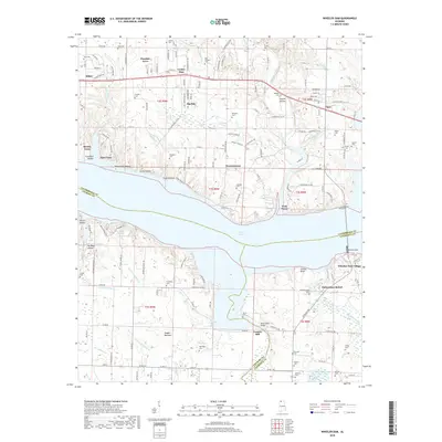
2018 Map of Wheeler Dam
USGS Topo · Published 2018About this map
Wilson Lake dominates this landscape, created by the massive Wheeler Dam structure at the convergence of Lauderdale, Colbert, and Lawrence counties. The modern shoreline is dotted with residential and recreational developments such as Wheeler Dam Village, Fishermans Resort, and Brooks Acres, while the surrounding terrain preserves deep-rooted family history. Numerous small cemeteries, including Old Tanyard Cem, Hennigan Cem, and Douglass Cem, are scattered across the uplands, often situated near named hollows like Trousdale Hollow and Shinglemill Hollow.
Find a feature on this map
167 named features on this map. Tap any name to fly to it.
Don’t see what you’re looking for? This feature index may not catch every label — zoom into the map to look around manually.
Map Details
Editions of this 2018 Wheeler Dam Map
This is the sole edition of this map. No revisions or reprints were ever made.
Other maps of this area

1914 · Rogersville
USGS Topo · 1:48,000

1914 · Muscle Shoals
USGS Topo · 1:48,000

1916 · Muscle Shoals
USGS Topo · 1:62,500

1916 · Rogersville
USGS Topo · 1:62,500

1924 · Tuscumbia
USGS Topo · 1:48,000

1926 · Tuscumbia
USGS Topo · 1:62,500

1936 · Thorntontown
USGS Topo · 1:24,000

1936 · Courtland
USGS Topo · 1:24,000

1936 · Lexington
USGS Topo · 1:24,000

1936 · Pruitton
USGS Topo · 1:24,000