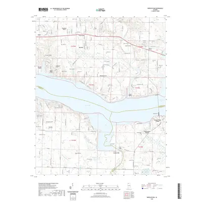
2020 Map of Wheeler Dam
USGS Topo · Published 2020About this map
Wheeler Dam and the navigation infrastructure of Lock Three anchor this landscape along the Tennessee River. North of the river, the terrain is defined by a series of hollows, including Trousdale Hollow and Ingram Hollow, which channel small tributaries like Bluewater Creek toward the main channel. Small settlements such as Killen, Center Star, and Houstontown are interspersed with numerous family burial grounds, including the Old Tanyard Cem and Harden Cem.
Find a feature on this map
190 named features on this map. Tap any name to fly to it.
Don’t see what you’re looking for? This feature index may not catch every label — zoom into the map to look around manually.
Map Details
Editions of this 2020 Wheeler Dam Map
This is the sole edition of this map. No revisions or reprints were ever made.
Other maps of this area

1914 · Rogersville
USGS Topo · 1:48,000

1914 · Muscle Shoals
USGS Topo · 1:48,000

1916 · Muscle Shoals
USGS Topo · 1:62,500

1916 · Rogersville
USGS Topo · 1:62,500

1924 · Tuscumbia
USGS Topo · 1:48,000

1926 · Tuscumbia
USGS Topo · 1:62,500

1936 · Thorntontown
USGS Topo · 1:24,000

1936 · Courtland
USGS Topo · 1:24,000

1936 · Lexington
USGS Topo · 1:24,000

1936 · Pruitton
USGS Topo · 1:24,000