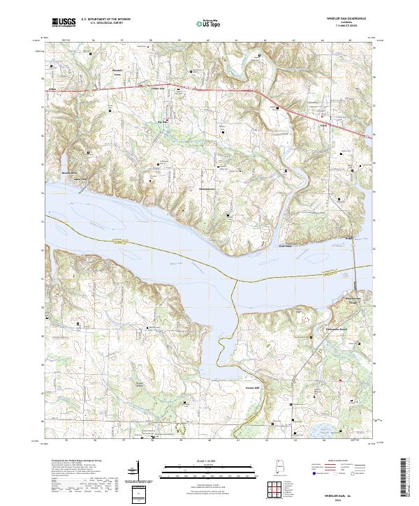
2024 Map of Wheeler Dam
USGS Topo · Published 2024About this map
Wheeler Dam serves as the dominant landmark on this Alabama landscape, spanning the Tennessee River to form Wheeler Lake and Wilson Lake. The surrounding area in Lauderdale and Colbert counties shows a transition from structured settlements like Killen and Elgin to the low-lying terrain of Bugger Bottom and Tupelo Bottoms. The river's influence is evident in the development of Fishermans Resort and the presence of Lock Three, while the higher ground is marked by numerous family burial sites, including the Gabriel Butler Cem and Harden Cem.
Find a feature on this map
167 named features on this map. Tap any name to fly to it.
Don’t see what you’re looking for? This feature index may not catch every label — zoom into the map to look around manually.
Map Details
Editions of this 2024 Wheeler Dam Map
This is the sole edition of this map. No revisions or reprints were ever made.
Other maps of this area

1914 · Rogersville
USGS Topo · 1:48,000

1914 · Muscle Shoals
USGS Topo · 1:48,000

1916 · Muscle Shoals
USGS Topo · 1:62,500

1916 · Rogersville
USGS Topo · 1:62,500

1924 · Tuscumbia
USGS Topo · 1:48,000

1926 · Tuscumbia
USGS Topo · 1:62,500

1936 · Thorntontown
USGS Topo · 1:24,000

1936 · Courtland
USGS Topo · 1:24,000

1936 · Lexington
USGS Topo · 1:24,000

1936 · Pruitton
USGS Topo · 1:24,000