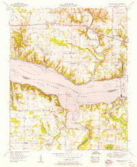
1952 Map of Wheeler Dam
USGS Topo · Published 1957About this map
Wheeler Dam anchors this landscape where the Tennessee River broadens into Wilson Lake, marking a critical juncture of infrastructure and recreation in the early 1950s. The map illustrates the residential footprint of Wheeler Dam Village and the adjacent Joe Wheeler State Park, which emerged alongside the hydroelectric project. Further inland, the map documents the rural distribution of communities like Center Star, Elgin, and the vanished site of Houstontown. Numerous family burial grounds such as Harden Cem and Williams Cem are scattered across the terrain, providing valuable data for genealogists. The presence of Fosters Mill and Ebenezer Sch reflects a post-war rural economy still deeply tied to local landmarks and small-scale agriculture. The complex drainage of the region is traced through Town Creek and its many branches, while Lee Highway serves as the primary artery connecting these north Alabama settlements.
Find a feature on this map
54 named features on this map. Tap any name to fly to it.
Don’t see what you’re looking for? This feature index may not catch every label — zoom into the map to look around manually.
Map Details
Editions of this 1952 Wheeler Dam Map
This is the sole edition of this map. No revisions or reprints were ever made.
Other maps of this area

1914 · Rogersville
USGS Topo · 1:48,000

1914 · Muscle Shoals
USGS Topo · 1:48,000

1916 · Muscle Shoals
USGS Topo · 1:62,500

1916 · Rogersville
USGS Topo · 1:62,500

1924 · Tuscumbia
USGS Topo · 1:48,000

1926 · Tuscumbia
USGS Topo · 1:62,500

1936 · Thorntontown
USGS Topo · 1:24,000

1936 · Courtland
USGS Topo · 1:24,000

1936 · Lexington
USGS Topo · 1:24,000

1936 · Pruitton
USGS Topo · 1:24,000