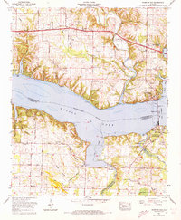
1971 Map of Wheeler Dam
USGS Topo · Published 1973About this map
The Tennessee River serves as the central artery of this region, separating Lauderdale County from Colbert and Lawrence Counties. The 1971 landscape is defined by the massive Wheeler Dam and the expanse of Wilson Lake, which transformed the local topography. Along the northern banks, established communities like Center Star and Elgin sit near the Lee Highway, while the creation of Joe Wheeler State Park and Wheeler Dam Village reflects the era's focus on hydroelectric development and recreation.
Find a feature on this map
71 named features on this map. Tap any name to fly to it.
Don’t see what you’re looking for? This feature index may not catch every label — zoom into the map to look around manually.
Map Details
Editions of this 1971 Wheeler Dam Map
2 editions found
Other maps of this area

1914 · Rogersville
USGS Topo · 1:48,000

1914 · Muscle Shoals
USGS Topo · 1:48,000

1916 · Muscle Shoals
USGS Topo · 1:62,500

1916 · Rogersville
USGS Topo · 1:62,500

1924 · Tuscumbia
USGS Topo · 1:48,000

1926 · Tuscumbia
USGS Topo · 1:62,500

1936 · Thorntontown
USGS Topo · 1:24,000

1936 · Courtland
USGS Topo · 1:24,000

1936 · Lexington
USGS Topo · 1:24,000

1936 · Pruitton
USGS Topo · 1:24,000