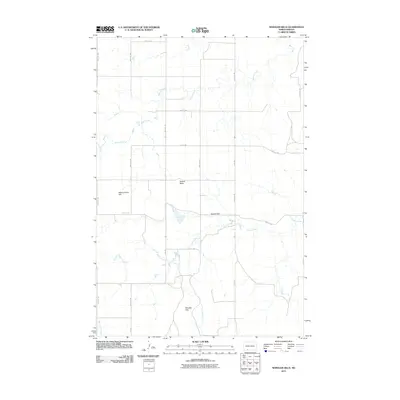
2011 Map of Wheeler Hills
USGS Topo · Published 2011About this map
Morris Creek and Snake Creek drain this section of Grant County, cutting through an upland landscape defined by isolated peaks and high ground. The namesake Wheeler Hills dominate the southern portion of the quadrangle, while Russell Butte and the curiously named Blind Johnny Hill rise as prominent landmarks to the north and west. This 2011 survey reveals a vast, open topography structured by a rigid section-line road grid, including Leith Rd and Heil Rd. Human intervention in the local hydrology is evident at Howard Dam, where the terrain begins to slope toward the drainage of Crooked Creek. The map provides a precise look at the rural infrastructure of the North Dakota prairie in the early 21st century, showing how the natural draws of Whitmore Creek intersect with the man-made corridors of the Great Plains.
Find a feature on this map
21 named features on this map. Tap any name to fly to it.
Don’t see what you’re looking for? This feature index may not catch every label — zoom into the map to look around manually.
Map Details
Editions of this 2011 Wheeler Hills Map
This is the sole edition of this map. No revisions or reprints were ever made.
Other maps of this area

1954 · Bismarck
USGS Topo · 1:250,000

1958 · Bismarck
USGS Topo · 1:250,000

1972 · Carson SE
USGS Topo · 1:24,000

1972 · Leith
USGS Topo · 1:24,000

1972 · Paradise Flats
USGS Topo · 1:24,000

1972 · Wheeler Hills
USGS Topo · 1:24,000

1972 · Pretty Rock Butte
USGS Topo · 1:24,000

1972 · Sheep Creek Dam
USGS Topo · 1:24,000

1972 · Pretty Rock Butte SE
USGS Topo · 1:24,000
1972 · Pitt Creek
USGS Topo · 1:24,000