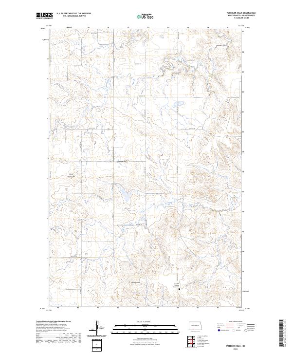
2024 Map of Wheeler Hills
USGS Topo · Published 2024About this map
Wheeler Hills rise above the drainage basins of Grant County, where the high prairie is defined by slow-moving watercourses and isolated geological landmarks. The landscape is structured by a strict section-line road grid, including Heil Rd and 81st St SW, which serve the scattered farmsteads of this rural interior. Significant elevations such as Russell Butte and Blind Johnny Hill break the horizon, providing orientation in an otherwise open expanse of grassland.
Find a feature on this map
22 named features on this map. Tap any name to fly to it.
Don’t see what you’re looking for? This feature index may not catch every label — zoom into the map to look around manually.
Map Details
Editions of this 2024 Wheeler Hills Map
This is the sole edition of this map. No revisions or reprints were ever made.
Other maps of this area

1954 · Bismarck
USGS Topo · 1:250,000

1958 · Bismarck
USGS Topo · 1:250,000

1972 · Carson SE
USGS Topo · 1:24,000

1972 · Leith
USGS Topo · 1:24,000

1972 · Paradise Flats
USGS Topo · 1:24,000

1972 · Wheeler Hills
USGS Topo · 1:24,000

1972 · Pretty Rock Butte
USGS Topo · 1:24,000

1972 · Sheep Creek Dam
USGS Topo · 1:24,000

1972 · Pretty Rock Butte SE
USGS Topo · 1:24,000
1972 · Pitt Creek
USGS Topo · 1:24,000