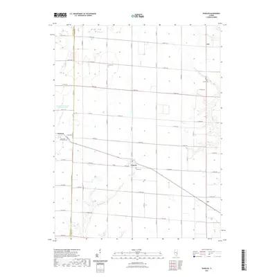
2021 Map of Wheeler
USGS Topo · Published 2021About this map
The borderlands of Effingham Co and Jasper Co are defined by a grid of agricultural section roads and the winding paths of several creeks. The village of Wheeler serves as a central hub for the area, situated near the confluence where Big Muddy Cr and Laws Cr drain the surrounding fields. This landscape reflects the enduring rural character of central Illinois, with small settlements like Gila and Lis anchored by local landmarks. Genealogists will find several burial sites recorded here, including Brewer Cem and the Immaculate Conception Cem near Dieterich. To the northwest, the Rocky Ford Sportsman Club South Lake offers a rare deviation from the agricultural pattern, highlighting the intersection of natural drainage and local recreational development in the 21st century.
Find a feature on this map
37 named features on this map. Tap any name to fly to it.
Don’t see what you’re looking for? This feature index may not catch every label — zoom into the map to look around manually.
Map Details
Editions of this 2021 Wheeler Map
This is the sole edition of this map. No revisions or reprints were ever made.
Other maps of this area

1940 · Greenup
USGS Topo · 1:62,500

1941 · Newton
USGS Topo · 1:62,500

1943 · Greenup
USGS Topo · 1:62,500

1943 · Newton
USGS Topo · 1:62,500

1953 · Teutopolis
USGS Topo · 1:62,500

1953 · Sailor Springs
USGS Topo · 1:62,500

1958 · Decatur
USGS Topo · 1:250,000

1958 · Belleville
USGS Topo · 1:250,000

1961 · Decatur
USGS Topo · 1:250,000

1962 · Belleville
USGS Topo · 1:250,000