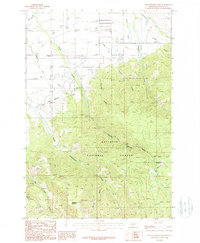
1987 Map of Wheeler Mountain
USGS Topo · Published 1987About this map
The northern reaches of the Gallatin National Forest meet the agricultural and municipal fringes of Gallatin County in this late 1980s topographic study. The landscape is defined by the complex water management infrastructure essential to the region, including the Gallatin Canal, the Middle Creek Association Ditch, and a municipal Filtration Plant. Rural educational and communication hubs like the Anderson Sch and the Radio Towers (KBOZ) serve the scattered populations living near the mouth of the canyons.
Find a feature on this map
28 named features on this map. Tap any name to fly to it.
Don’t see what you’re looking for? This feature index may not catch every label — zoom into the map to look around manually.
Map Details
Editions of this 1987 Wheeler Mountain Map
2 editions found
Other maps of this area

1888 · Three Forks
USGS Topo · 1:250,000

1891 · Livingston
USGS Topo · 1:250,000

1893 · Livingston
USGS Topo · 1:250,000

1894 · Three Forks
USGS Topo · 1:250,000

1895 · Three Forks
USGS Topo · 1:250,000

1947 · Bozeman
USGS Topo · 1:250,000

1948 · Bozeman
USGS Topo · 1:250,000

1951 · Bozeman Pass
USGS Topo · 1:62,500

1953 · Bozeman
USGS Topo · 1:62,500

1955 · Bozeman
USGS Topo · 1:250,000