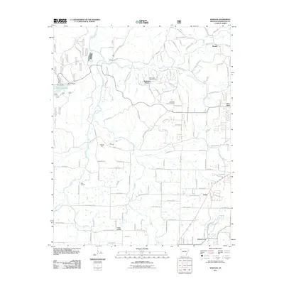
2011 Map of Wheeler
USGS Topo · Published 2011About this map
Illinois River and its major tributaries, including Clear Creek and Muddy Fork, dominate this portion of the Ozark plateau west of Fayetteville. The landscape is characterized by a mix of agricultural tracts and growing residential clusters such as Savoy and Wedington Woods. Local history is anchored by sites like Bell Cemetery and Rose Cemetery, alongside the sprawling University of Arkansas Experimental Farm. To the northwest, the Lake Weddington Dam creates a significant water body within the timbered terrain, while smaller communities like Viney Grove and Starks reflect the traditional settlement patterns of the region. The map also documents specialized infrastructure, including the Wedington Wood Airport and the complex network of rural roads that connect the heights of Weaver Hill to the valley floors of Goose Creek and Hamstring Creek.
Find a feature on this map
143 named features on this map. Tap any name to fly to it.
Don’t see what you’re looking for? This feature index may not catch every label — zoom into the map to look around manually.
Map Details
Editions of this 2011 Wheeler Map
This is the sole edition of this map. No revisions or reprints were ever made.
Other maps of this area

1898 · Winslow
USGS Topo · 1:125,000

1899 · Fayetteville
USGS Topo · 1:125,000

1901 · Winslow
USGS Topo · 1:125,000

1901 · Fayetteville
USGS Topo · 1:125,000

1904 · Fayetteville
USGS Topo · 1:125,000

1946 · Fort Smith
USGS Topo · 1:250,000

1954 · Tulsa
USGS Topo · 1:250,000

1958 · Fayetteville
USGS Topo · 1:24,000

1958 · Tulsa
USGS Topo · 1:250,000

1963 · Tulsa
USGS Topo · 1:250,000