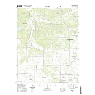
2017 Map of Wheeler
USGS Topo · Published 2017About this map
The Illinois River snakes through the western edge of Fayetteville, carving a valley that separates the growing urban reach from the protected Ozark National Forest. This 2017 study illustrates the intersection of modern aviation and rural heritage, where the Wedington Woods Airport sits just north of historic family markers like Bell Cem. To the northwest, the settlement of Savoy marks the confluence of Clear Creek and the river, while the southwestern corner is defined by the winding Muddy Fork. The landscape is a transition of residential growth and natural preserves, anchored by landmarks such as Lake Weddington and White Rock. Small rural pockets like Weaver Hill and Wheeler persist alongside the expanding boundaries of Farmington and Prairie Grove, providing a clear view of how development follows the arterial roads into the Arkansas hills.
Find a feature on this map
139 named features on this map. Tap any name to fly to it.
Don’t see what you’re looking for? This feature index may not catch every label — zoom into the map to look around manually.
Map Details
Editions of this 2017 Wheeler Map
This is the sole edition of this map. No revisions or reprints were ever made.
Other maps of this area

1898 · Winslow
USGS Topo · 1:125,000

1899 · Fayetteville
USGS Topo · 1:125,000

1901 · Winslow
USGS Topo · 1:125,000

1901 · Fayetteville
USGS Topo · 1:125,000

1904 · Fayetteville
USGS Topo · 1:125,000

1946 · Fort Smith
USGS Topo · 1:250,000

1954 · Tulsa
USGS Topo · 1:250,000

1958 · Fayetteville
USGS Topo · 1:24,000

1958 · Tulsa
USGS Topo · 1:250,000

1963 · Tulsa
USGS Topo · 1:250,000