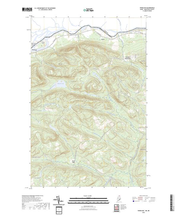
2024 Map of Wheelock
USGS Topo · Published 2024About this map
Violette Settlement and Wheelock stand as small outposts in this heavily forested section of Aroostook County, where the landscape is defined by the winding course of the St John River. Along the northern edge, the river marks the international boundary between the United States and Canada, with Savage Island and Pierre overlooking the water. The interior is dominated by timbered heights like Bossy Mtn and Michaud Hill, separated by a complex network of waterways including Wheelock Brook, which drains from Wheelock Lake. Historically significant routes like Carter Brook Tote Rd and Wallagrass Tote Rd suggest a legacy of logging and transport through the woods to the site of Burnt Mill on Wallagrass Stream.
Find a feature on this map
37 named features on this map. Tap any name to fly to it.
Don’t see what you’re looking for? This feature index may not catch every label — zoom into the map to look around manually.
Map Details
Editions of this 2024 Wheelock Map
This is the sole edition of this map. No revisions or reprints were ever made.
Other maps of this area

1928 · Eagle Lake
USGS Topo · 1:48,000

1930 · St Francis
USGS Topo · 1:48,000

1931 · Eagle Lake
USGS Topo · 1:62,500

1932 · Fort Kent
USGS Topo · 1:48,000

1933 · St Francis
USGS Topo · 1:62,500

1935 · Fort Kent
USGS Topo · 1:62,500

1962 · Edmundston
USGS Topo · 1:250,000
1975 · St Francis SE
USGS Topo · 1:24,000
1975 · St Francis NE
USGS Topo · 1:24,000
1975 · Fort Kent SE
USGS Topo · 1:24,000
Featured Places
- Fort Kent, ME
- Wallagrass, ME
- Saint John Plantation, ME
- Burnt Mill, Saint John Plantation
- Wheelock, Saint John Plantation