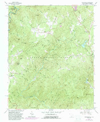
1961 Map of Whetstone
USGS Topo · Published 1988About this map
Stumphouse Mountain and the Chattoga Ridge dominate this section of the Sumter National Forest along the Georgia and South Carolina border. The landscape is defined by the sharp descent from the ridge into the drainage basins of the Chattooga River and Chauga River. Small mountain communities like Mountain Rest and Whetstone serve as focal points for local history, featuring numerous landmarks such as the Long Creek Academy and several country churches including Monte Vista Ch and Mountain Rest Ch.
Find a feature on this map
85 named features on this map. Tap any name to fly to it.
Don’t see what you’re looking for? This feature index may not catch every label — zoom into the map to look around manually.
Map Details
Editions of this 1961 Whetstone Map
4 editions found
Other maps of this area

1886 · Walhalla
USGS Topo · 1:125,000

1892 · Walhalla
USGS Topo · 1:125,000

1896 · Walhalla
USGS Topo · 1:125,000

1935 · Rabun Bald
USGS Topo · 1:24,000
1946 · Rabun Bald
USGS Topo · 1:24,000
1947 · Rabun Bald
USGS Topo · 1:24,000

1954 · Greenville
USGS Topo · 1:250,000

1957 · Tugaloo Lake
USGS Topo · 1:24,000
1957 · Rainy Mountain
USGS Topo · 1:24,000

1958 · Greenville
USGS Topo · 1:250,000