
2020 Map of Whirlwind Valley SW
USGS Topo · Published 2020About this map
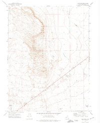
Coyote Knolls and the high ridges of Millard County dominate this interior landscape, where water management is critical to the local geography. Significant catchment features like Antelope Spring Reservoir and Soap Hollow Reservoir are mapped alongside natural drainage systems such as Tin Well Wash. The terrain transitions from the elevations of Soap Hollow down toward the intermittent waters of Rain Lakes in the south. Transportation in this arid environment relies on established routes like Swazey Springs Rd and the historical corridor of Old 6 & 50. The topographic detail reveals a network of canyons and ridges, including the prominent Death Canyon Rd, which traces the rugged floor of the namesake canyon through the western portion of the quadrangle.
Find a feature on this map
10 named features on this map. Tap any name to fly to it.
Don’t see what you’re looking for? This feature index may not catch every label — zoom into the map to look around manually.
Map Details
Editions of this 2020 Whirlwind Valley SW Map
This is the sole edition of this map. No revisions or reprints were ever made.
Other maps of this area

1908 · Fish Springs
USGS Topo · 1:250,000

1910 · Fish Springs
USGS Topo · 1:250,000

1953 · Delta
USGS Topo · 1:250,000

1958 · Delta
USGS Topo · 1:250,000

1960 · Notch Peak
USGS Topo · 1:62,500

1962 · Delta
USGS Topo · 1:250,000

1972 · Whirlwind Valley SW
USGS Topo · 1:24,000
1972 · Long Ridge
USGS Topo · 1:24,000

1972 · Long Ridge Reservoir
USGS Topo · 1:24,000
1972 · Swasey Peak
USGS Topo · 1:24,000