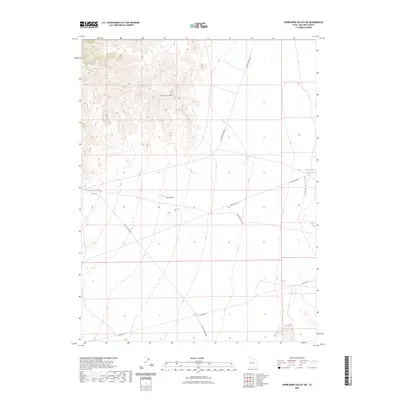
2023 Map of Whirlwind Valley SW
USGS Topo · Published 2023About this map
Swasey Mtn dominates the northwestern corner of this West Desert landscape, rising above a network of desert tracks and drainages. The area is defined by its arid geography, where water management is centralized at sites like Antelope Spring Reservoir and Soap Hollow Reservoir. These reservoirs, along with the distinct elevations of Coyote Knolls, indicate a region primarily utilized for rangeland or seasonal transit rather than permanent settlement.
Find a feature on this map
9 named features on this map. Tap any name to fly to it.
Don’t see what you’re looking for? This feature index may not catch every label — zoom into the map to look around manually.
Map Details
Editions of this 2023 Whirlwind Valley SW Map
This is the sole edition of this map. No revisions or reprints were ever made.
Other maps of this area

1908 · Fish Springs
USGS Topo · 1:250,000

1910 · Fish Springs
USGS Topo · 1:250,000

1953 · Delta
USGS Topo · 1:250,000

1958 · Delta
USGS Topo · 1:250,000

1960 · Notch Peak
USGS Topo · 1:62,500

1962 · Delta
USGS Topo · 1:250,000

1972 · Whirlwind Valley SW
USGS Topo · 1:24,000
1972 · Long Ridge
USGS Topo · 1:24,000

1972 · Long Ridge Reservoir
USGS Topo · 1:24,000
1972 · Swasey Peak
USGS Topo · 1:24,000