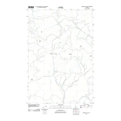
2011 Map of Whiskey Butte
USGS Topo · Published 2011About this map
Whiskey Butte and the surrounding drainage of Whiskey Creek define this Idaho landscape, where high ridges separate numerous tributaries flowing toward the northern reaches of the Dworshak Reservoir. The map reveals a history of resource extraction, highlighted by the Democrat Mine and the nearby Crawford Mine situated along the slopes of Democrat Mountain. These sites are linked by a network of forest roads like Grangemont Rd and Snake Creek Rd, which navigate the steep terrain between Cow Creek Saddle and the valley of Cow Creek. Small settlements and seasonal locations like Cully Moores and Porters Camp provide evidence of local residence and forestry activity, while Konkols Pond and the Campbells Pond Access Area mark points of water access within the dense creek network that feeds into Orofino Creek and beyond.
Find a feature on this map
37 named features on this map. Tap any name to fly to it.
Don’t see what you’re looking for? This feature index may not catch every label — zoom into the map to look around manually.
Map Details
Editions of this 2011 Whiskey Butte Map
This is the sole edition of this map. No revisions or reprints were ever made.
Other maps of this area

1923 · Washington Creek
USGS Topo · 1:125,000

1924 · Kamiah
USGS Topo · 1:125,000

1924 · Weippe
USGS Topo · 1:125,000

1938 · Headquarters
USGS Topo · 1:48,000

1944 · Headquarters
USGS Topo · 1:62,500

1955 · Pullman
USGS Topo · 1:250,000

1956 · Hamilton
USGS Topo · 1:250,000

1958 · Pullman
USGS Topo · 1:250,000

1959 · Hamilton
USGS Topo · 1:250,000

1960 · Hamilton
USGS Topo · 1:250,000