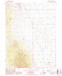
1986 Map of Whistler Mtn
USGS Topo · Published 1987About this map
Whistler Mountain dominates the western half of this Nevada landscape, transitioning sharply into the wide, flat expanse of Diamond Valley to the east. The terrain is defined by a sparse but essential network of water sources, including Stinking Spring, Hash Spring, and Trap Corral Spring, which likely served as critical hubs for regional livestock and travel. An Old RR Grade cuts through the southeastern corner of the valley, signaling the area's historical connection to early mining or transport infrastructure. The valley floor is dotted with numerous wells and a notable Slough, indicating a reliance on groundwater in this arid environment. Several prospects and a Gravel Pit appear along the mountain's lower slopes, documenting the persistent search for mineral wealth that characterized this part of Eureka County during the late 20th century.
Find a feature on this map
14 named features on this map. Tap any name to fly to it.
Don’t see what you’re looking for? This feature index may not catch every label — zoom into the map to look around manually.
Map Details
Editions of this 1986 Whistler Mtn Map
This is the sole edition of this map. No revisions or reprints were ever made.
Other maps of this area

1926 · Roberts Mountains
USGS Topo · 1:250,000

1929 · Roberts Mountains
USGS Topo · 1:250,000

1949 · Garden Valley
USGS Topo · 1:62,500

1951 · Garden Valley
USGS Topo · 1:62,500

1953 · Eureka
USGS Topo · 1:62,500

1955 · Millett
USGS Topo · 1:250,000

1956 · Whistler Mtn
USGS Topo · 1:62,500

1956 · Ely
USGS Topo · 1:250,000

1957 · Diamond Springs
USGS Topo · 1:62,500

1959 · Ely
USGS Topo · 1:250,000