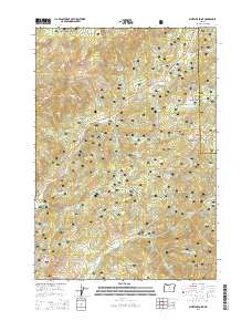
2014 Map of Whistler Point
USGS Topo · Published 2014About this map
The Ochoco National Forest defines this high-elevation landscape in the Ochoco Mountains, where numerous peaks and springs suggest a history of seasonal grazing and water management. High points like Whistler Point, Hamilton Butte, and Grant Butte overlook a complex network of seasonal drainages and named water sources, including Marks Lake and Whitney Reservoir. The presence of open areas such as Grant Meadows and Spears Meadow, along with specific family-named landmarks like Koch Reservoir, points to the long-standing integration of forest management and early ranching interests in this part of Crook County. Primitive roads like the Old Ochoco Hwy and Summit Rd snake through the drainage basins of Marks Cr and Ochoco Cr, tracing the historical transit routes used before modern forest developments.
Find a feature on this map
72 named features on this map. Tap any name to fly to it.
Don’t see what you’re looking for? This feature index may not catch every label — zoom into the map to look around manually.
Map Details
Editions of this 2014 Whistler Point Map
This is the sole edition of this map. No revisions or reprints were ever made.
Other maps of this area

1926 · Mitchell
USGS Topo · 1:125,000

1948 · Ochoco Reservoir
USGS Topo · 1:62,500

1950 · Ochoco Reservoir
USGS Topo · 1:62,500

1951 · Lookout Mtn
USGS Topo · 1:62,500

1955 · Bend
USGS Topo · 1:250,000

1957 · Bend
USGS Topo · 1:250,000

1958 · Bend
USGS Topo · 1:250,000

1968 · Lawson Mtn
USGS Topo · 1:24,000

1968 · Stephenson Mtn
USGS Topo · 1:24,000

1968 · Opal Mountain
USGS Topo · 1:24,000