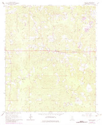
1964 Map of Whistler
USGS Topo · Published 1982About this map
Whistler and its surrounding countryside in Wayne County appear here as they were documented in the mid-1960s, a landscape defined by small churches and family-named landmarks. The map traces a network of rural life through sites like Boyles Chapel, Lowery Ch, and Melain Chapel, while several burial grounds including Arrington Cem and Mozingo Cem provide valuable touchstones for genealogists. The terrain is marked by an intricate drainage system including Yellow Creek, Maynor Creek, and Big Creek, with the prominent Whistler Lookout Tower standing over the undulating hills. Industrial activity of the period is evident in the numerous Gravel Pits concentrated in the northeastern section near the Mississippi-Wayne Co. line. An Old Railroad Grade cutting through the southwestern portion reflects the changing transportation infrastructure as timber or agricultural rail lines were surpassed by the expanding road network.
Find a feature on this map
37 named features on this map. Tap any name to fly to it.
Don’t see what you’re looking for? This feature index may not catch every label — zoom into the map to look around manually.
Map Details
Editions of this 1964 Whistler Map
2 editions found
Other maps of this area

1953 · Hattiesburg
USGS Topo · 1:250,000

1958 · Hattiesburg
USGS Topo · 1:250,000

1964 · Heidelberg SW
USGS Topo · 1:24,000

1964 · Eucutta
USGS Topo · 1:24,000

1964 · Myrick
USGS Topo · 1:24,000

1964 · Clara
USGS Topo · 1:24,000

1964 · Strengthford
USGS Topo · 1:24,000

1964 · Waynesboro
USGS Topo · 1:24,000

1964 · Whistler
USGS Topo · 1:24,000

1964 · Shubuta
USGS Topo · 1:24,000