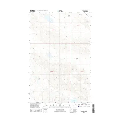
2014 Map of Whitcomb Lake
USGS Topo · Published 2014About this map
Whitcomb Lake and its surrounding drainage basin define this high plains landscape in Phillips County. This modern survey illustrates the hydrology of a region where water management is central to the land's utility, marked by the presence of the First Creek Reservoir and the drainage patterns of First Creek and the N Fork First Cr. The terrain is characterized by distinct geological depressions and watercourses, such as the notably named The Big Sag and Alkali Coulee.
Find a feature on this map
14 named features on this map. Tap any name to fly to it.
Don’t see what you’re looking for? This feature index may not catch every label — zoom into the map to look around manually.
Map Details
Editions of this 2014 Whitcomb Lake Map
This is the sole edition of this map. No revisions or reprints were ever made.
Other maps of this area

1954 · Jordan
USGS Topo · 1:250,000

1954 · Glasgow
USGS Topo · 1:250,000

1956 · Jordan
USGS Topo · 1:250,000

1957 · Glasgow
USGS Topo · 1:250,000

1958 · Glasgow
USGS Topo · 1:250,000

1958 · Jordan
USGS Topo · 1:250,000

1964 · Jordan
USGS Topo · 1:250,000

1965 · Sun Prairie
USGS Topo · 1:24,000

1965 · Whitcomb Lake
USGS Topo · 1:24,000
1965 · Stratton Reservoir
USGS Topo · 1:24,000