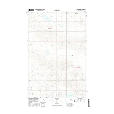
2017 Map of Whitcomb Lake
USGS Topo · Published 2017About this map
Whitcomb Lake sits in the northern reaches of this landscape, a prominent hydrological feature in a region defined by complex drainage patterns and seasonal water flow. To the south, the First Cr Reservoir manages the waters of First Creek, which is further fed by the North Fork First Cr. The terrain is characterized by distinct geological depressions and drainages, most notably The Big Sag and Alkali Coulee, illustrating the erosional forces that have shaped this portion of Phillips County. In the northern section, the headwaters of the South Fork Sheep Coulee and North Fork Sheep Coulee demonstrate the watershed's northward orientation toward larger basins, providing a clear picture of the area's natural irrigation and topographic relief.
Find a feature on this map
13 named features on this map. Tap any name to fly to it.
Don’t see what you’re looking for? This feature index may not catch every label — zoom into the map to look around manually.
Map Details
Editions of this 2017 Whitcomb Lake Map
This is the sole edition of this map. No revisions or reprints were ever made.
Other maps of this area

1954 · Jordan
USGS Topo · 1:250,000

1954 · Glasgow
USGS Topo · 1:250,000

1956 · Jordan
USGS Topo · 1:250,000

1957 · Glasgow
USGS Topo · 1:250,000

1958 · Glasgow
USGS Topo · 1:250,000

1958 · Jordan
USGS Topo · 1:250,000

1964 · Jordan
USGS Topo · 1:250,000

1965 · Sun Prairie
USGS Topo · 1:24,000

1965 · Whitcomb Lake
USGS Topo · 1:24,000
1965 · Stratton Reservoir
USGS Topo · 1:24,000