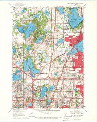
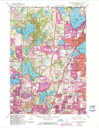
1967 Map of White Bear Lake West
USGS Topo · Published 1969About this map
Vadnais Heights and North Oaks appear here during a period of significant suburban expansion, where traditional rail corridors meet the growing needs of the Twin Cities metropolitan area. The landscape is defined by its glacial lakes, from the large expanse of Pleasant Lake to the residential edges of White Bear Lake. Transportation infrastructure is in flux, evidenced by the Soo Line and Northern Pacific railroads intersecting with a proposed lane location for future highway development. Institutional and community landmarks such as Lakewood State Jr College, the County Home, and numerous local schools like Snail Lake Sch anchor the burgeoning neighborhoods of Roseville and Maplewood. The presence of the Benson Airport and several radio towers reflects the era's technological footprint amidst a complex network of marshes and water bodies like Vadnais Lake.
Find a feature on this map
82 named features on this map. Tap any name to fly to it.
Don’t see what you’re looking for? This feature index may not catch every label — zoom into the map to look around manually.
Map Details
Editions of this 1967 White Bear Lake West Map
5 editions found
Other maps of this area

1896 · St. Paul
USGS Topo · 1:62,500

1902 · White Bear
USGS Topo · 1:62,500

1946 · Hudson
USGS Topo · 1:62,500

1948 · Stillwater
USGS Topo · 1:62,500

1949 · Hudson
USGS Topo · 1:62,500

1949 · Stillwater
USGS Topo · 1:62,500

1949 · Lake Elmo
USGS Topo · 1:24,000

1950 · Lake Elmo
USGS Topo · 1:24,000

1951 · White Bear Lake East
USGS Topo · 1:24,000

1951 · St. Paul West
USGS Topo · 1:24,000