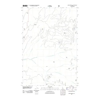
2011 Map of White Bird Hill
USGS Topo · Published 2011About this map
White Bird Hill Summit towers over a landscape defined by dramatic elevation changes and a complex network of ridges and drainage basins. This 2011 survey by the U. S. Geological Survey documents the intricate topography of north-central Idaho, where the White Bird Creek system is fed by numerous tributaries including the North Fork White Bird Creek and South Fork White Bird Creek. The naming conventions found on the map, such as Dentist Parlor Ridge, Poe Saddle, and Bentz Ridge, reflect a long history of local land use and geographic orientation. Access to the high ground is marked by roads like Old Hwy 95 and Service Flats Rd, which cut through areas such as Burnt Flats and Service Flats. This cartography provides a clear view of the transition from high summits to the more sheltered waters of Bull Run Cove.
Find a feature on this map
31 named features on this map. Tap any name to fly to it.
Don’t see what you’re looking for? This feature index may not catch every label — zoom into the map to look around manually.
Map Details
Editions of this 2011 White Bird Hill Map
This is the sole edition of this map. No revisions or reprints were ever made.
Other maps of this area

1955 · Grangeville
USGS Topo · 1:250,000

1959 · Grangeville
USGS Topo · 1:250,000

1963 · McKinzie Creek
USGS Topo · 1:24,000

1963 · Goodwin Meadows
USGS Topo · 1:24,000

1963 · Grangeville West
USGS Topo · 1:24,000

1963 · White Bird Hill
USGS Topo · 1:24,000

1963 · Slate Creek
USGS Topo · 1:24,000
1963 · Grangeville East
USGS Topo · 1:24,000
1963 · Dairy Mountain
USGS Topo · 1:24,000

1963 · White Bird
USGS Topo · 1:24,000