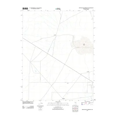
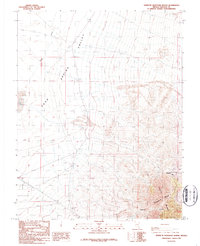
2012 Map of White Blotch Springs NE
USGS Topo · Published 2012About this map
Sand Spring Valley dominates the eastern expanse of this Lincoln County quadrangle, where the arid basin floor meets a network of local agricultural and ranching tracks. The map illustrates a landscape of intermittent water sources and isolated human activity, anchored by the settlement at Sundown and the nearby Sundown Spring. These features, along with the scattered locations of Windmill Number One and Windmill Number Two, suggest a reliance on subsurface water to support the small-scale operations at Penoyer Farms. A complex grid of roads, including Gunderson Rd, Desert Dog Rd, and Gunnerson Connect, crisscrosses the valley floor, providing a detailed record of the transportation network used by residents and ranchers in this sparsely populated section of the Nevada desert during the early 21st century.
Find a feature on this map
21 named features on this map. Tap any name to fly to it.
Don’t see what you’re looking for? This feature index may not catch every label — zoom into the map to look around manually.
Map Details
Editions of this 2012 White Blotch Springs NE Map
This is the sole edition of this map. No revisions or reprints were ever made.
Other maps of this area

1942 · Penoyer Valley
USGS Topo · 1:125,000

1952 · White Blotch Springs
USGS Topo · 1:62,500

1954 · Caliente
USGS Topo · 1:250,000

1959 · Caliente
USGS Topo · 1:250,000

1964 · Tempiute Mtn
USGS Topo · 1:62,500
1985 · Black Top
USGS Topo · 1:24,000

1985 · Worthington Peak SW
USGS Topo · 1:24,000
1986 · Honest John Well
USGS Topo · 1:24,000
1987 · Tempiute Mountain South
USGS Topo · 1:24,000
1987 · Tempiute Mountain North
USGS Topo · 1:24,000