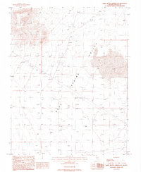
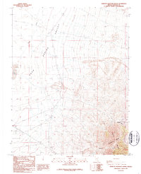
1987 Map of White Blotch Springs NE
USGS Topo · Published 1988About this map
Sand Spring Valley dominates this 1980s landscape in Lincoln County, Nevada, where the desert floor is punctuated by the infrastructure of isolated ranching and resource extraction. The presence of Penoyer Farms in the south-central portion of the quadrangle suggests the specialized agricultural activity common in high-desert basins. This basin environment is further defined by essential water sources like Sand Spring and various scattered wells that served the area's inhabitants and livestock. A Landing Strip located near the farms highlights the necessity of aerial transport in these wide-open spaces of the Great Basin. The map provides a clear record of land division and elevation benchmarks across this arid terrain, showing the surveyed township and range lines that structured settlement in the region.
Find a feature on this map
10 named features on this map. Tap any name to fly to it.
Don’t see what you’re looking for? This feature index may not catch every label — zoom into the map to look around manually.
Map Details
Editions of this 1987 White Blotch Springs NE Map
This is the sole edition of this map. No revisions or reprints were ever made.
Other maps of this area

1942 · Penoyer Valley
USGS Topo · 1:125,000

1952 · White Blotch Springs
USGS Topo · 1:62,500

1954 · Caliente
USGS Topo · 1:250,000

1959 · Caliente
USGS Topo · 1:250,000

1964 · Tempiute Mtn
USGS Topo · 1:62,500
1985 · Black Top
USGS Topo · 1:24,000

1985 · Worthington Peak SW
USGS Topo · 1:24,000
1986 · Honest John Well
USGS Topo · 1:24,000
1987 · Tempiute Mountain South
USGS Topo · 1:24,000
1987 · Tempiute Mountain North
USGS Topo · 1:24,000