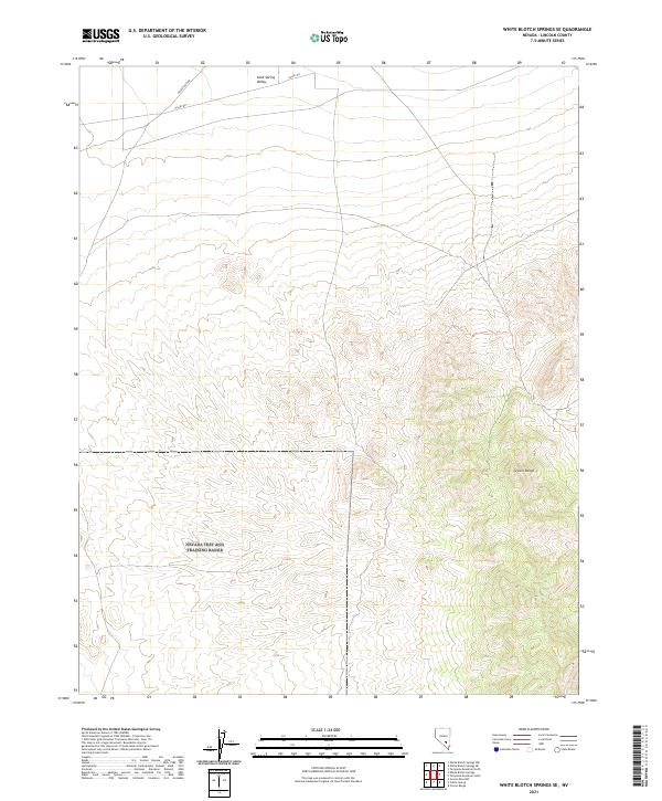
2021 Map of White Blotch Springs SE
USGS Topo · Published 2021About this map
Sand Spring Valley dominates the northern expanse of this Lincoln County quadrangle, where the desert floor meets the rising peaks of the Groom Range. This area of Nevada is characterized by a stark transition from the flat, open valley basin to the high-relief terrain of the range, which occupies the southeastern quadrant. Settlement is nearly non-existent in this portion of the high desert, with the landscape defined primarily by the Valley Rd corridor and Desert Dog Rd. The survey meticulously details the complex drainage patterns and elevation contours of the eastern Nevada basin-and-range topography, illustrating how these natural barriers shaped the sparse transportation network that cuts across the northern desert floor.
Find a feature on this map
8 named features on this map. Tap any name to fly to it.
Don’t see what you’re looking for? This feature index may not catch every label — zoom into the map to look around manually.
Map Details
Editions of this 2021 White Blotch Springs SE Map
This is the sole edition of this map. No revisions or reprints were ever made.
Other maps of this area

1942 · Emigrant Valley
USGS Topo · 1:125,000

1942 · Penoyer Valley
USGS Topo · 1:125,000

1952 · White Blotch Springs
USGS Topo · 1:62,500

1952 · Groom Mine
USGS Topo · 1:62,500

1954 · Caliente
USGS Topo · 1:250,000

1959 · Caliente
USGS Topo · 1:250,000

1964 · Tempiute Mtn
USGS Topo · 1:62,500

1985 · Pahranagat Range
USGS Topo · 1:100,000
1987 · Tempiute Mountain South
USGS Topo · 1:24,000
1987 · Tempiute Mountain North
USGS Topo · 1:24,000