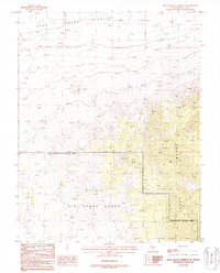
1987 Map of White Blotch Springs SE
USGS Topo · Published 1988About this map
Nellis Air Force Range dominates the southern half of this Nevada landscape, defined by military boundaries and a massive Restricted Access Area. This late-1980s provisional study captures a high-desert environment where the eastern horizon is defined by the peaks of the Groom Range. Settlement is absent, replaced by specialized infrastructure such as a Radio Facility, a Water Tank, and various 4wd tracks that thread through the high elevations. The northern terrain transitions into the Sand Spring Valley, where isolated wells are the primary indicators of human utility. Geologic interest is evident along the mountain slopes, where labels for Prospects, a Prospect, and a Drill Hole suggest mineral exploration within the rugged terrain of Lincoln County.
Find a feature on this map
11 named features on this map. Tap any name to fly to it.
Don’t see what you’re looking for? This feature index may not catch every label — zoom into the map to look around manually.
Map Details
Editions of this 1987 White Blotch Springs SE Map
This is the sole edition of this map. No revisions or reprints were ever made.
Other maps of this area

1942 · Emigrant Valley
USGS Topo · 1:125,000

1942 · Penoyer Valley
USGS Topo · 1:125,000

1952 · White Blotch Springs
USGS Topo · 1:62,500

1952 · Groom Mine
USGS Topo · 1:62,500

1954 · Caliente
USGS Topo · 1:250,000

1959 · Caliente
USGS Topo · 1:250,000

1964 · Tempiute Mtn
USGS Topo · 1:62,500

1985 · Pahranagat Range
USGS Topo · 1:100,000
1987 · Tempiute Mountain South
USGS Topo · 1:24,000
1987 · Tempiute Mountain North
USGS Topo · 1:24,000