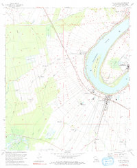
1974 Map of White Castle
USGS Topo · Published 1991About this map
The Mississippi River meanders sharply through this Iberville Parish landscape, defining the boundaries of long-established sugar and agriculture tracts like Tally Ho, Cedar Grove, and Cora. The town of White Castle serves as a primary hub, situated near the river levee and the Texas and Pacific railroad line. To the north, the historic Bayou Goula settlement sits near the river's edge, while the interior is marked by specialized industry and land use, ranging from the White Castle Oil Field and several large Crawfish Farm operations to the National Leprosarium at Point Clair. Smaller rural communities and family-named landings such as Samstown, Annadale, and Bruly La Croix are connected by a network of drainage canals and bayous, including Bayou Tigre and Bayou Danials. Religious life is deeply rooted here, evidenced by landmarks like the Madonna Chapel and St Paul Ch.
Find a feature on this map
45 named features on this map. Tap any name to fly to it.
Don’t see what you’re looking for? This feature index may not catch every label — zoom into the map to look around manually.
Map Details
Editions of this 1974 White Castle Map
2 editions found
Other maps of this area

1908 · Baton Rouge
USGS Topo · 1:62,500

1935 · Chicot Lake
USGS Topo · 1:62,500

1936 · White Castle
USGS Topo · 1:62,500

1939 · Baton Rouge
USGS Topo · 1:62,500

1940 · Grosse Tete
USGS Topo · 1:62,500

1953 · Crescent
USGS Topo · 1:24,000

1953 · Plaquemine
USGS Topo · 1:24,000

1953 · Addis
USGS Topo · 1:24,000

1953 · St. Gabriel
USGS Topo · 1:24,000
1953 · White Castle
USGS Topo · 1:24,000