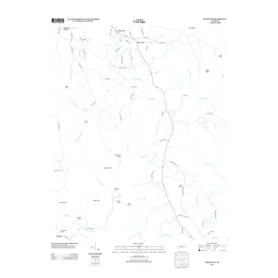
2013 Map of White City
USGS Topo · Published 2013About this map
White City and Lankford Town anchor the northern landscape of this plateau region, where the terrain is defined by deep coves and prominent ridges. The geography here is marked by the dramatic descent of water at Foster Falls and the carved paths of Big Fiery Gizzard Cr and Little Gizzard Cr. Local history is visible in the network of rural roads such as Old Stage Coach Rd and Gregg Cemetery Rd, which connect early 21st-century residential clusters with the more isolated southern settlements like Comfort. The landscape transitions from the residential layouts around Oak Grove to the steep, uninhabited overlooks of Raven Point and Speegle Point. This area showcases a mix of wooded ridgelines, like Big Ridge and Pryor Ridge, and tucked-away geological features such as Plummeting Springs and Denny Cove.
Find a feature on this map
75 named features on this map. Tap any name to fly to it.
Don’t see what you’re looking for? This feature index may not catch every label — zoom into the map to look around manually.
Map Details
Editions of this 2013 White City Map
This is the sole edition of this map. No revisions or reprints were ever made.
Other maps of this area

1895 · Sewanee
USGS Topo · 1:125,000

1936 · Palmer
USGS Topo · 1:24,000

1936 · Orme
USGS Topo · 1:24,000

1936 · Whitwell
USGS Topo · 1:24,000

1936 · Burrow Cove
USGS Topo · 1:24,000

1936 · Tracy City
USGS Topo · 1:24,000

1936 · Monteagle
USGS Topo · 1:24,000

1936 · White City
USGS Topo · 1:24,000
1936 · Sequatchie
USGS Topo · 1:24,000
1936 · South Pittsburg
USGS Topo · 1:24,000