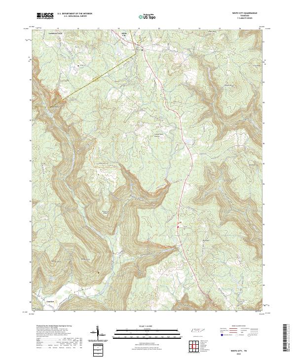
2022 Map of White City
USGS Topo · Published 2022About this map
Cumberland Plateau terrain dominates this portion of the South Cumberland region, where the Grundy and Marion County line cuts across the highland landscape. The settlement pattern is concentrated in the northern reaches at White City and Lankford Town, while the southern area transitions into the dramatic rim and cove topography characteristic of the area. Significant local history is preserved in the location of Oak Grove Cem and Gregg Cem, alongside the historic route of Old Stage Coach Rd. The map illustrates a complex drainage network where Big Fiery Gizzard Cr and its tributaries have carved deep recesses like Little Cove and Denny Cove. These natural features, combined with the presence of Fiery Gizzard Trl, reflect a landscape defined by its sharp elevation changes between prominent overlooks like Raven Point and the sheltered valley of Gizzard Cove.
Find a feature on this map
82 named features on this map. Tap any name to fly to it.
Don’t see what you’re looking for? This feature index may not catch every label — zoom into the map to look around manually.
Map Details
Editions of this 2022 White City Map
This is the sole edition of this map. No revisions or reprints were ever made.
Other maps of this area

1895 · Sewanee
USGS Topo · 1:125,000

1936 · Palmer
USGS Topo · 1:24,000

1936 · Orme
USGS Topo · 1:24,000

1936 · Whitwell
USGS Topo · 1:24,000

1936 · Burrow Cove
USGS Topo · 1:24,000

1936 · Tracy City
USGS Topo · 1:24,000

1936 · Monteagle
USGS Topo · 1:24,000

1936 · White City
USGS Topo · 1:24,000
1936 · Sequatchie
USGS Topo · 1:24,000
1936 · South Pittsburg
USGS Topo · 1:24,000