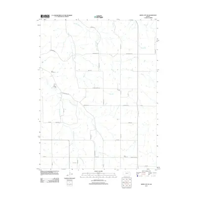
2012 Map of White City NE
USGS Topo · Published 2012About this map
The headwaters of Humboldt Cr define this rural Geary County landscape, where the stream divides into the E Br Humboldt Cr and W Br Humboldt Cr. This 2012 survey illustrates a classic Kansas township grid, where long-established cemeteries serve as the primary landmarks for the agricultural community. Genealogists and local historians can locate several burial grounds including Upper Humboldt Cem in the northwest and Quaker Cem to the south. The terrain is marked by numerous small tributaries like MacArthur Br and Thierer Br, while the presence of Moss Spring and Moss Springs Cem in the southeast corner points to a localized pocket of early settlement history. The road network, including Welcome Cemetery RD and Glessner Hill RD, follows the high ridges between the creek branches.
Find a feature on this map
28 named features on this map. Tap any name to fly to it.
Don’t see what you’re looking for? This feature index may not catch every label — zoom into the map to look around manually.
Map Details
Editions of this 2012 White City NE Map
This is the sole edition of this map. No revisions or reprints were ever made.
Other maps of this area

1885 · Eskridge
USGS Topo · 1:125,000

1886 · Junction City
USGS Topo · 1:125,000

1889 · Wamego
USGS Topo · 1:125,000

1889 · Junction City
USGS Topo · 1:125,000

1889 · Parkerville
USGS Topo · 1:125,000

1889 · Eskridge
USGS Topo · 1:125,000

1894 · Eskridge
USGS Topo · 1:125,000

1894 · Junction City
USGS Topo · 1:125,000

1894 · Parkerville
USGS Topo · 1:125,000

1894 · Wamego
USGS Topo · 1:125,000