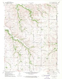
1971 Map of White City NE
USGS Topo · Published 1974About this map
Humboldt Creek and its many tributaries, including Poole Branch and Thicker Branch, carve through the rural uplands of Geary County in the early 1970s. The landscape is defined by its small community institutions and burial grounds, such as Upper Humboldt Cem and Quaker Cem, which serve as primary markers for the early families of Liberty and Wingfield townships.
Find a feature on this map
19 named features on this map. Tap any name to fly to it.
Don’t see what you’re looking for? This feature index may not catch every label — zoom into the map to look around manually.
Map Details
Editions of this 1971 White City NE Map
This is the sole edition of this map. No revisions or reprints were ever made.
Other maps of this area

1885 · Eskridge
USGS Topo · 1:125,000

1886 · Junction City
USGS Topo · 1:125,000

1889 · Wamego
USGS Topo · 1:125,000

1889 · Junction City
USGS Topo · 1:125,000

1889 · Parkerville
USGS Topo · 1:125,000

1889 · Eskridge
USGS Topo · 1:125,000

1894 · Eskridge
USGS Topo · 1:125,000

1894 · Junction City
USGS Topo · 1:125,000

1894 · Parkerville
USGS Topo · 1:125,000

1894 · Wamego
USGS Topo · 1:125,000