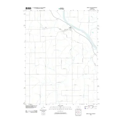
2009 Map of White Cloud
USGS Topo · Published 2009About this map
White Cloud sits perched on the bluffs overlooking a sharp bend in the Missouri River, where the landscape transitions from the river valley to the gridded agricultural uplands of Northeast Kansas. The town's layout is clearly defined by a traditional street grid including Main St, Missouri St, and numbered streets from 3rd St to 5th St. This area is characterized by several meandering waterways, such as Squaw Creek and Cedar Creek, which have carved deep drainage patterns through the terrain, most notably at Chalk Bluff.
Find a feature on this map
41 named features on this map. Tap any name to fly to it.
Don’t see what you’re looking for? This feature index may not catch every label — zoom into the map to look around manually.
Map Details
Editions of this 2009 White Cloud Map
This is the sole edition of this map. No revisions or reprints were ever made.
Other maps of this area

1885 · Atchison
USGS Topo · 1:125,000

1888 · Atchison
USGS Topo · 1:125,000

1893 · Atchison
USGS Topo · 1:125,000

1920 · Craig
USGS Topo · 1:62,500

1926 · Oregon
USGS Topo · 1:62,500

1926 · Maitland
USGS Topo · 1:62,500

1950 · Kansas City
USGS Topo · 1:250,000

1954 · Kansas City
USGS Topo · 1:250,000

1955 · Nebraska City
USGS Topo · 1:250,000

1956 · Kansas City
USGS Topo · 1:250,000