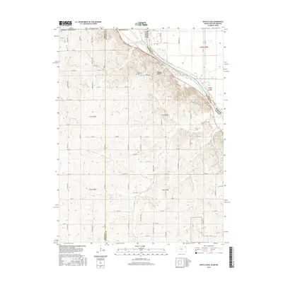
2016 Map of White Cloud
USGS Topo · Published 2016About this map
White Cloud sits on the bluffs overlooking the wide valley of the Missouri River in this 2016 topographic study. This particular reach of the river forms the border between Kansas, Missouri, and Nebraska, illustrating the complex hydrology of a river system that has historically defined state boundaries. The terrain south and west of the settlement is characterized by deeply incised drainages and steep loess hills that rise sharply from the river plain. While the township grid remains the primary organizing force for rural roads, the topography forces a winding path for the routes that descend toward the water. This modern record reflects the enduring relationship between the community and the great river that once served as a primary artery for trade and migration in the American West.
Find a feature on this map
2 named features on this map. Tap any name to fly to it.
Don’t see what you’re looking for? This feature index may not catch every label — zoom into the map to look around manually.
Map Details
Editions of this 2016 White Cloud Map
This is the sole edition of this map. No revisions or reprints were ever made.
Other maps of this area

1885 · Atchison
USGS Topo · 1:125,000

1888 · Atchison
USGS Topo · 1:125,000

1893 · Atchison
USGS Topo · 1:125,000

1920 · Craig
USGS Topo · 1:62,500

1926 · Oregon
USGS Topo · 1:62,500

1926 · Maitland
USGS Topo · 1:62,500

1950 · Kansas City
USGS Topo · 1:250,000

1954 · Kansas City
USGS Topo · 1:250,000

1955 · Nebraska City
USGS Topo · 1:250,000

1956 · Kansas City
USGS Topo · 1:250,000