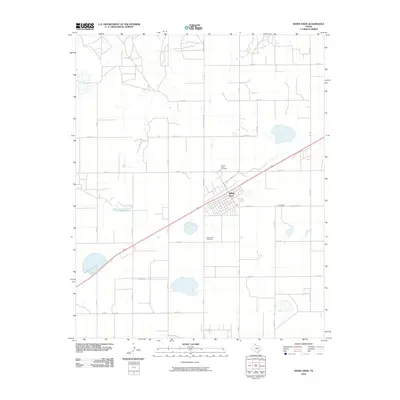
2010 Map of White Deer
USGS Topo · Published 2010About this map
White Deer is situated at the heart of this High Plains landscape, where the grid of Carson County roads meets the diagonal passage of the railroad and highway. The town's layout is clearly defined by its central streets, including Bier St, McKenzie St, and E Bell Ave. This 2010 survey illustrates the structured agricultural environment of the Panhandle, with a network of rural routes such as Fm 2385 and Old White Deer Rd connecting outlying farms to the town center. The presence of both Sacred Heart Cemetery and the White Deer Cemetery provides specific points of interest for genealogists tracing local families. The ephemeral drainage of White Deer Creek cuts through the northern sections of the map, contrasting with the otherwise geometric precision of the land divisions and irrigation patterns characteristic of this region.
Find a feature on this map
26 named features on this map. Tap any name to fly to it.
Don’t see what you’re looking for? This feature index may not catch every label — zoom into the map to look around manually.
Map Details
Editions of this 2010 White Deer Map
This is the sole edition of this map. No revisions or reprints were ever made.
Other maps of this area

1953 · Borger SE
USGS Topo · 1:24,000

1954 · Amarillo
USGS Topo · 1:250,000

1958 · Amarillo
USGS Topo · 1:250,000

1963 · Skellytown
USGS Topo · 1:24,000

1965 · White Deer
USGS Topo · 1:24,000

1965 · Lake Mc Connell
USGS Topo · 1:24,000

1966 · Grandview School
USGS Topo · 1:24,000

1966 · Panhandle East
USGS Topo · 1:24,000

1966 · Cuyler
USGS Topo · 1:24,000

1966 · White Deer SW
USGS Topo · 1:24,000