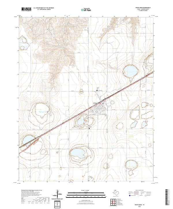
2022 Map of White Deer
USGS Topo · Published 2022About this map
White Deer occupies a central position on this High Plains survey, its street grid oriented both to the cardinal directions and the diagonal path of the regional transportation corridor. The community's local history is anchored by Sacred Heart Cem to the north and White Deer Cem to the south, marking the established boundaries of the settlement. The surrounding landscape in Carson County is defined by a sparse but systematic network of section roads, including Old White Deer Rd and several numbered routes like FM 2385. Topographically, the area is characterized by the headwaters of White Deer Cr, which creates a series of draws and depressions in the northern portion of the quadrangle. This pattern of drainage and road placement illustrates the adaptation of local infrastructure to the subtle shifts in the Panhandle's terrain.
Find a feature on this map
48 named features on this map. Tap any name to fly to it.
Don’t see what you’re looking for? This feature index may not catch every label — zoom into the map to look around manually.
Map Details
Editions of this 2022 White Deer Map
This is the sole edition of this map. No revisions or reprints were ever made.
Other maps of this area

1953 · Borger SE
USGS Topo · 1:24,000

1954 · Amarillo
USGS Topo · 1:250,000

1958 · Amarillo
USGS Topo · 1:250,000

1963 · Skellytown
USGS Topo · 1:24,000

1965 · White Deer
USGS Topo · 1:24,000

1965 · Lake Mc Connell
USGS Topo · 1:24,000

1966 · Grandview School
USGS Topo · 1:24,000

1966 · Panhandle East
USGS Topo · 1:24,000

1966 · Cuyler
USGS Topo · 1:24,000

1966 · White Deer SW
USGS Topo · 1:24,000