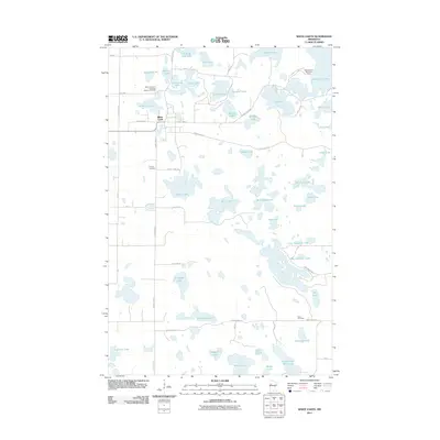
2011 Map of White Earth
USGS Topo · Published 2011About this map
White Earth serves as the central settlement in this lake-heavy landscape within the White Earth Indian Reservation. The map documents a territory defined by glacial hydrology, with dozens of named water bodies like Big Tamarack Lake, White Earth Lake, and Trading Post Lake scattered across the township lines. For genealogists and local historians, several specific sites provide valuable spatial context, including Saint Columba's Episcopal Mission Cemetery near the village and the Aura Cemetery to the southeast. The layout of county roads, such as County Hwy-21 and County Hwy-34, illustrates the modern connectivity between these isolated water features and the Wabaunaquat Boy Scout Camp on the shores of White Earth Lake. This 2011 survey records the contemporary road network and drainage patterns in a region historically significant for its indigenous heritage and recreational waterways.
Find a feature on this map
62 named features on this map. Tap any name to fly to it.
Don’t see what you’re looking for? This feature index may not catch every label — zoom into the map to look around manually.
Map Details
Editions of this 2011 White Earth Map
This is the sole edition of this map. No revisions or reprints were ever made.
Other maps of this area

1953 · Brainerd
USGS Topo · 1:250,000

1954 · Bemidji
USGS Topo · 1:250,000

1957 · Brainerd
USGS Topo · 1:250,000

1957 · Bemidji
USGS Topo · 1:250,000

1958 · Bemidji
USGS Topo · 1:250,000

1958 · Brainerd
USGS Topo · 1:250,000

1959 · Flat Lake
USGS Topo · 1:24,000

1959 · Richwood
USGS Topo · 1:24,000
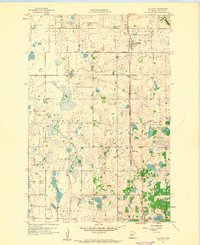
1959 · Callaway
USGS Topo · 1:24,000

1965 · Brainerd
USGS Topo · 1:250,000